

|
Katuwana Fort |
Katuwana Fort (Sinhala: කටුවන ඕලන්ද බලකොටුව; Tamil: கட்டுவனைக் கோட்டை) is an inland Dutch fort situated in Katuwana town in Hambantota District, Sri Lanka.
History
The area where the present fort is situated is said to have been used by King Vijayabahu I (1055-1110 A.D.) as a security zone during the Polonnaruwa Period. However, solid evidence about the existence of fortifications at Katuwana before the period of the Dutch (Dutch Ceylon: 1658-1796 A.D.) is absent (Jayasena, 2006). The Dutch built the fort at Katuwana to provide security to the route that stretched between Kandy and Matara and to render protection to the commercial activities they were undertaking.
Before the Dutch
After Prince Dharmapala (1550-1597 A.D.), the Kingdom of Kotte fell into the hands of the Portuguese (Portuguese Ceylon: 1597-1658 A.D.) and the Sinhalese crown went to the king of Kandy (Jayasena, 2006). King Vimaladharmasuriya I (1592-1604 A.D.) of Kandy sent an army south to claim the former kingdom but the army was held back at Katuwana by the pro-Portuguese military commander Samarakon (Jayasena, 2006). In 1617 and again in 1649, Katuwana was in the middle of battles (Jayasena, 2006).
The Presence of the Dutch
Two military campaigns (1638–1640 A.D. and 1655–1658 A.D.) by the Dutch ended Portuguese power in Sri Lanka and they, for various reasons, kept the Portuguese-built forts for themselves and started to build new fortifications in various parts of the country where they had military power (Jayasena, 2006). Inland fortifications were made by them at places such as Pitigala, Mapalagama, Akuressa, Hakmana, and Katuwana (Jayasena, 2006). The instructions to the Governor-General of Dutch Ceylon from the Governor-General and Council of India for the years 1656-1665 pointed out that the field fortification at Katuwana should be garrisoned with trustworthy officers and soldiers (Jayasena, 2006).
The field fortification at Katuwana, as the earliest record, dates from 1661 and that structure stood there until about 1680 when the stone fort which still exists today was completed (Jayasena, 2006; Jayasena & Floore, 2010). The construction of the stone fort was begun in 1679 at the site (Jayasena, 2006).
In 1761, the fort along with the outpost at Hanwella and the fort at Matara was besieged and attacked by the army of the Kandyan Kingdom (Jayasena, 2006; Jayasena & Floore, 2010; Mandawala, 2012).
The British occupation
The Dutch were succeeded by the British in 1796. The fort was then under the control of the British during the period between 1796 and 1805 (Jayasena, 2006). The Kandyan army who attacked the British in 1805, captured the fort but subsequently abandoned it (Jayasena, 2006).
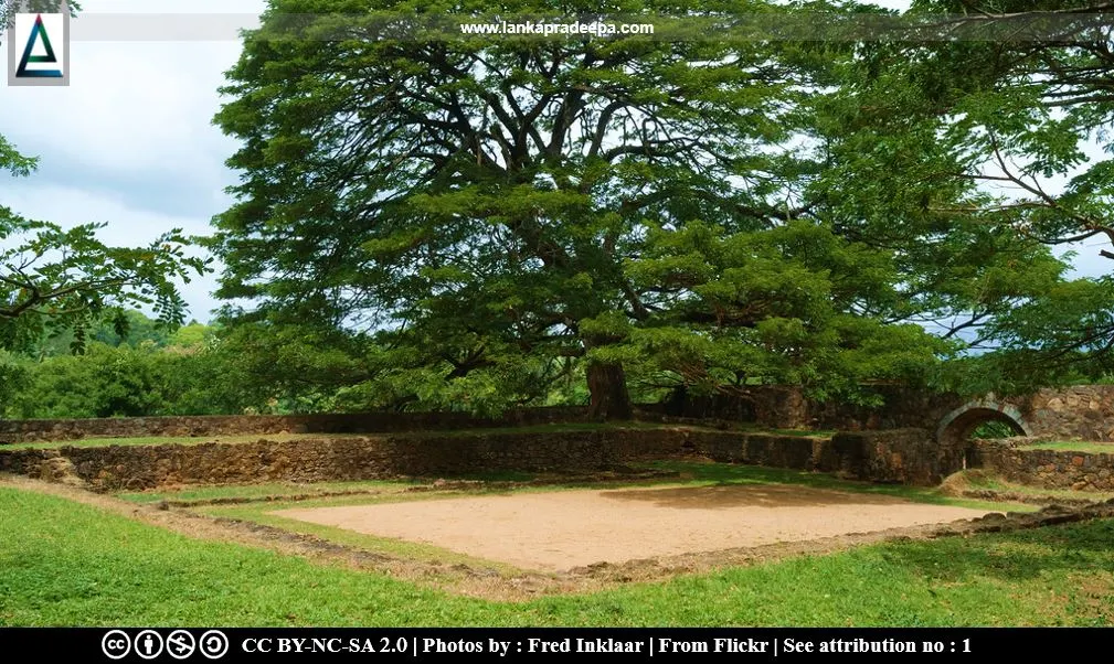
The Fort
The fort has been constructed on a hill on the eastern bank of Urubokka Oya (Jayasena, 2006). It is a square fort with two diagonally opposed bastions (Jayasena, 2006; Jayasena & Floore, 2010). It was known as "Catoene" during the 17th and 18th centuries A.D. (Jayasena & Floore, 2010).
At present, the fort can be entered through a gap cut in the western curtain wall (Jayasena & Floore, 2010). However, a map belonging to about 1700 A.D. reveals that it had two gates but another map of 1717 A.D. by Dutch Governor I. Rumpf shows one gate in the northern curtain (Jayasena & Floore, 2010). A 1734 map by J.W. Heydt indicates the gateway at the present location and further mentions that it had only one entrance (Jayasena & Floore, 2010).
The height of the fort is 16 cubits from the outside and 11 cubits from the inside. The inner area of the fort is 756 square meters (Jayasena & Floore, 2010). A plan of the fort, dating to c.1700 A.D., reveals that its main internal structures consisted of long ranges of rooms backing onto the south, east, and north defences (Jayasena, 2006). However, no internal structures are found in the fort today but a foundation of an old building and a large well are found in the southeast corner and in the northwest corner of the fort respectively (Jayasena, 2006).
Excavations
In 2000, an excavation was carried out at Katuwana Fort by PGIAR (The Postgraduate Institute of Archaeology) of the University of Kelaniya and AAC (Amsterdam Archaeological Centre) of the University of Amsterdam (Jayasena & Floore, 2010). Evidence of porcelain and pottery usage was found during their investigations (Jayasena, 2006; Schenk, 2013).
|
Katuwana Fort |
Related Posts
Read Also
References
Books, Journal Articles
1) Jayasena, R.M., 2006. The historical archaeology of Katuwana, a Dutch East India Company fort in Sri Lanka. Post-Medieval Archaeology, 40(1), pp.111-128.
2) Jayasena, R. and Floore, P., 2010. Dutch forts of seventeenth century Ceylon and Mauritius: an historical
archaeological perspective. In First Forts (pp. 235-260). Brill.
3) Mandawala, P.B., 2012. Sri Lanka: Defending the military heritage; legal, administrative and financial challenges. Defending the military heritage; legal, financial, and administrative issues. Reports from the Seminar 16 – 17 May, 2011, in Karlskrona, Sweden, organised by ICOMOS International Scientific Committee for Legal, Financial and Administrative Issues (ICLAFI) and the Swedish Fortifications Agency of Sweden. p.103.
4) Schenk, H., 2013. Porcelain from the East and earthenware from the neighbourhood–Remarks on the pottery from Dutch Fort Katuwana. Zeitschrift für Archäologie Außereuropäischer Kulturen, 5, pp.241-260.
Location Map
Dynamic Google Map
Attribution
To Whom
1) Inside the Dutch Fort by Fred Inklaar is licensed under CC BY-NC-SA 2.0
2) Dutch Fort entrance gate by Fred Inklaar is licensed under CC BY-NC-SA 2.0
