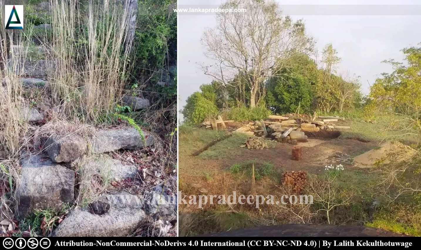
Beligala (Sinhala: බෙලිගල) is a small mountain with the ruins of an ancient fortress situated in Beligala village near Beligala Raja Maha Viharaya in Kegalle District, Sri Lanka.
History
As mentioned in the chronicles, King Vijayabahu III (1232-1236 A.D.) of Dambadeniya built a
fortress on the Billaselapabbata (Beligala) mountain to deposit the
Tooth and Bowl Relics of the Buddha safe during the turbulent period
after the fall of Polonnaruwa Kingdom
(Abeyawardana, 2002; Nicholas, 1963). The ruins of this ancient fortress are still found on the
Beligala mountain located in close proximity to the present Beligala Viharaya.
Beligala fortress
Beligala rock is nearly 190 m (623.36 ft. amsl) high and inaccessible on all sides except in the northeast. A rock-cut flight of steps facilitates one to ascend the rock and there is a cave (about 16 m deep by 4.5 m wide) named Mura-ge (guardhouse) on the halfway up (Bell, 1904; De Silva, 1990). The remains of a stone rampart, broken pillars and steps which appear to have been a gateway are found after the Mura-ge cave (De Silva, 1990). Beyond that, there is a flat space of about 45 m by 20 m and the pathway goes round to the summit to the south side where most probably the palace of the king was situated (De Silva, 1990).
The summit of the rock is split into two by a chasm about 6 m deep and 5 m broad (Bell, 1904; De Silva, 1990). It had been connected through a bridge and the Dalada Maligawa (the Temple of the Tooth Relic) is believed to have stood on this part of the rock (Bell, 1904; De Silva, 1990). Remains of the pillared buildings, stones, ponds, and caves are found scattered throughout the summit of the rock.
Although there are not many architectural remains of artistic value found, Beligala takes rank with the Fortress at Yapahuwa (Bell, 1904; De Silva, 1990).
A protected site
The remains of ancient structures and inscriptions scattered on Beligala mountain in the Divisional Secretary Division of Warakapola are archaeological protected monuments, declared by a government gazette
notification published on 28 December 1973. Attribution
#) LankaPradeepa.com would like to thank Lalith Kekulthotuwage for providing the necessary photographs required for this article. All the photos are published here with the permission of the author.
References
1) Abeyawardana, H.A.P., 2002. Heritage of Sabaragamuwa: Major natural, cultural and historic sites. Sabaragamuwa Development Bank and The Central Bank of Sri Lanka. ISBN: 955-575-077-7. pp.62-63.
2) Bell, H.C.P., 1904. Report on the Kegalle District of the Province of
Sabaragamuwa. Archaeological Survey of Ceylon: XIX-1892. Government
Press, Sri Lanka. pp.25-28.
3) De Silva, N., 1990. Sri Lankan architecture during the period 1200-1500 A.D. Wijesekara, N. (Editor in chief). Archaeological Department centenary
(1890-1990): Commemorative series: Volume III: Architecture. Department
of Archaeology (Sri Lanka). p.78.
4) Nicholas, C. W., 1963. Historical topography of ancient and medieval
Ceylon. Journal of the Ceylon Branch of the Royal Asiatic Society, New
Series (Vol VI). Special Number: Colombo. Royal Asiatic Society (Ceylon
Branch). p.124.
5) The government gazette notification, no: 92. 28 December 1973.
Location Map
This page was last updated on 30 July 2023

