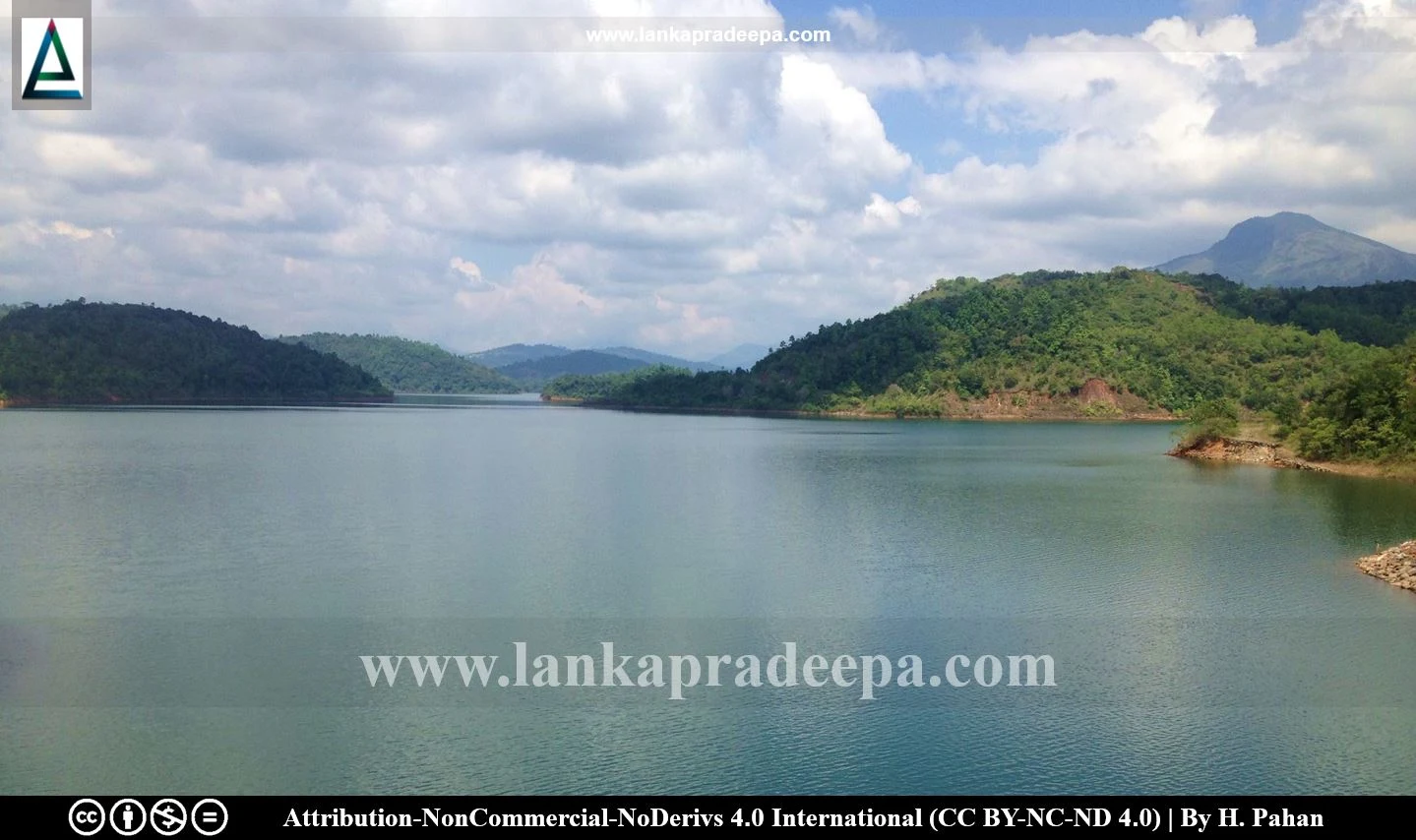
Samanalawewa Reservoir (Sinhala: සමනලවැව ජලාශය) is situated in Belihul Oya in Ratnapura District, Sri Lanka. It is considered one of the most important hydropower-generating reservoirs in the country (Udayakumara et al., 2010).
History
Detailed designs for the Samanalawewa project were originally prepared in the late 1970s and a design review was undertaken in 1985 (Nagel, 1992). Work on the construction of the reservoir along with a 110 m high dam commenced in 1988 and was completed in 1992 (Udayakumara & Gunawardena, 2018; Laksiri et al., 2009).
The reservoir
Located at an elevation of 400 m mean sea level, the reservoir has been built by damming the Walawe Ganga river at a confluence with its tributary, the Belihul Oya (Arumugam, 1969; Udayakumara et al., 2010). It extends in an area of 897 ha within Imbulpe and Balangoda Divisional Secretariat Divisions (DSDs), and its hydro power station is situated in the DSD of Weligepola (Udayakumara & Gunawardena, 2018).
Main parameters of the Samanalawewa dam & reservoir (Laksiri et al., 2009),
-
Reservoir catchment area: 341.7 km2
Normal high water level: EL460 m
Minimum Operating level: EL424m
Dam height: 110 m
Dam body volume: 4.5 million m3
Reservoir live storage volume: 218 million m3
Spillway design discharge: 3,600 m3/s
Power station capacity: 120 MW
-
Average annual run-off: 561 million m3
Design flood water level: EL460.7 m
Dam crest elevation: EL463m
Dam length: 530 m
Reservoir gross storage volume: 278 million m3
Reservoir dead storage: 60 million m3
Spillway type: Gated ogee
Average annual energy expected: 405 GWh
.
Water leakage
The Samanalawewa project gained significant attention due to water leakage problems encountered during its initial trial impoundment (Laksiri, 2007; Laksiri et al., 2005). In October 1992 a flat water table was observed up to a distance of 2.5 km on the right bank of the dam and also, a landslip occurred approximately 300 m downstream of the dam generating serious concern amongst the local residents that the dam was failing and there would be a serious loss of life (Khaniya et al., 2020; Laksiri et al., 2005; Udayakumara & Gunawardena, 2018). As a result of these incidents, it was decided to reduce the water level of the reservoir to 430 m and this level is maintained until the present time (Laksiri, 2007; Udayakumara & Gunawardena, 2018).
Several remedial measures such as grout curtain and wet blanketing were undertaken to seal off the leakage but all the attempts failed (Laksiri et al., 2009; Udayakumara & Gunawardena, 2018). Therefore, the reservoir is still operating with a continuous water leakage of 1,800 litres per second (Laksiri, 2007; Laksiri et al., 2005).
No solution for water leakage?
Geologically, the reservoir is located in an area of karst within the Highland series of the Sri Lankan Precambrian complex comprised of crystalline metamorphic rocks (Laksiri et al., 2005). The area has been subjected to extensive folding, faulting and hydrothermal reactions and because of these complex geological conditions, finding the exact mechanism of leakage has become an impossible task, thus preventing successful remediation for water leakage (Laksiri et al., 2005).
Samanalawewa Hydroelectric Project
Samanalawewa reservoir is the main element of the 120 MW Samanalawewa Hydroelectric Project. It consists of a water intake structure on the Walawe Ganga river (5.35 km long 4.5 m diameter headrace tunnel), 120 MW surface power station, two 132 kV transmission lines and 650 m long, open tail race canal releasing water back to Katupath Oya (Laksiri, 2007).

.
References
1) Arumugam, S., 1969. Water resources of Ceylon: its utilisation and development. Water Resources Board. p.405.
2) Khaniya, B., Karunanayake, C., Gunathilake, M.B. and Rathnayake, U., 2020. Projection of future hydropower generation in Samanalawewa power plant, Sri Lanka. Mathematical Problems in Engineering, 2020. pp.1-11.
3) Laksiri, L.K., 2007. Investigation of Water Leakage Mechanism in the Karstic Dam Site, Samanalawewa, Srilanka (Doctoral dissertation, PhD thesis, Saga University, Saga, Japan). pp.1-3,12.
4) Laksiri, K., Gunathilake, J. and Iwao, Y., 2005. A case study of the Samanalawewa reservoir on the Walawe river in an area of Karst in Sri Lanka. In Sinkholes and the Engineering and Environmental Impacts of Karst. pp. 253-262.
5) Laksiri, K., Gunathilake, J. and Iwao, Y., 2009. An Assessment of Leakage Ingress Areas Samanalawewa Reservoir – Sri Lanka. Geotechnical Journal, SLGS, Volume 4, Number 1.
6) Nagel, K.H., 1992. Limits of the geological predictions constructing the Samanalawewa pressure tunnel, Sri Lanka. Bulletin of the International Association of Engineering Geology-Bulletin de l'Association Internationale de Géologie de l'Ingénieur, 45(1), pp.97-110.
7) Udayakumara, E.P.N. and Gunawardena, U.A.D.P., 2018. Cost-benefit analysis of Samanalawewa Hydroelectric Project in Sri Lanka: An ex-post analysis. Earth Systems and Environment, 2(2), pp.401-412.
8) Udayakumara, E.P.N., Shrestha, R.P., Samarakoon, L. and Schmidt-Vogt, D., 2010. People's perception and socioeconomic determinants of soil erosion: A case study of Samanalawewa watershed, Sri Lanka. International journal of sediment research, 25(4), pp.323-339.
Location Map
This page was last updated on 17 July 2022

