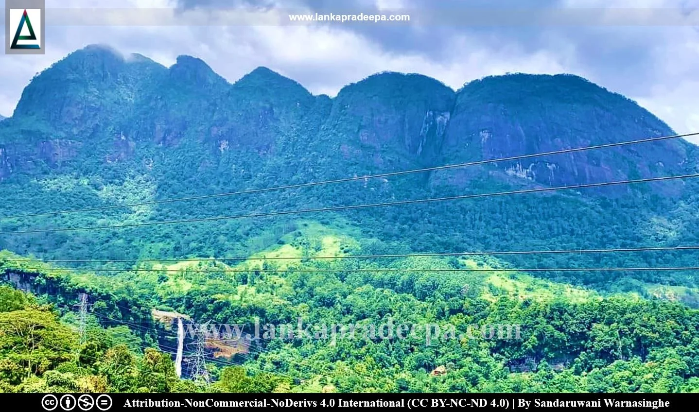
Saptha Kanya (Sinhala: සප්ත කන්යා කඳු වැටිය) is a mountain range located near the sacred Sri Pada Mountain in Sri Lanka. It is a ridge comprising seven peaks near the Norton Estate bordering the Sabaragamuwa and Central provinces. The highest of the seven peaks rises to an altitude of 1,571 meters (5,154.19 ft.) above mean sea level.
In the Sinhala language, Sapta Kanya means "the Seven Virgins". On 4 December 1974, Martinair Flight 138, a chartered flight from Surabaya, East Java, Indonesia, to Colombo, Sri Lanka, crashed on the fifth mountain of the range killing all 191 people aboard [(182 Indonesian hajj pilgrims bound for Mecca, and 9 crew members) Weeratna et al., 2018]. This crash is still considered the deadliest in Sri Lankan aviation history (Weeratna et al., 2018).
Presently, a small memorial has been erected to commemorate this accident in Norton Bridge town located several miles distance from the crash site. A tire of the aeroplane which was recovered from the crash site has been put on display to the public. Another memorial plate has been erected near the crash site carrying the names of the crew of the flight.
The heights of each peak of the mountain range;
| Mountain Peak | Height (MAMSL) |
| Saptha Kanya Peak 1 | 1,396 m (4,580.05 ft.) |
| Saptha Kanya Peak 2 | 1,406 m (4,612.86 ft.) |
| Saptha Kanya Peak 3 | 1,405 m (4,609.58 ft.) |
| Saptha Kanya Peak 4 | ? |
| Saptha Kanya Peak 5 | 1,454 m (4,770.34 ft.) |
| Saptha Kanya Peak 6 | 1,470 m (4,822.83 ft.) |
| Saptha Kanya Peak 7 | 1,571 m (5,154.19 ft.) |
References
1) Weeratna, J.B., Gunawardena, S.A., Mendis, N.A. and Perera, J.M., 2018. Odontological identification in the AN - 32 air crash at Hokandara. Sri Lanka Dental Journal 48(01). pp.32-40.
Explore Other Nearby Attractions
Location Map (Google)
This page was last updated on 5 August 2023

