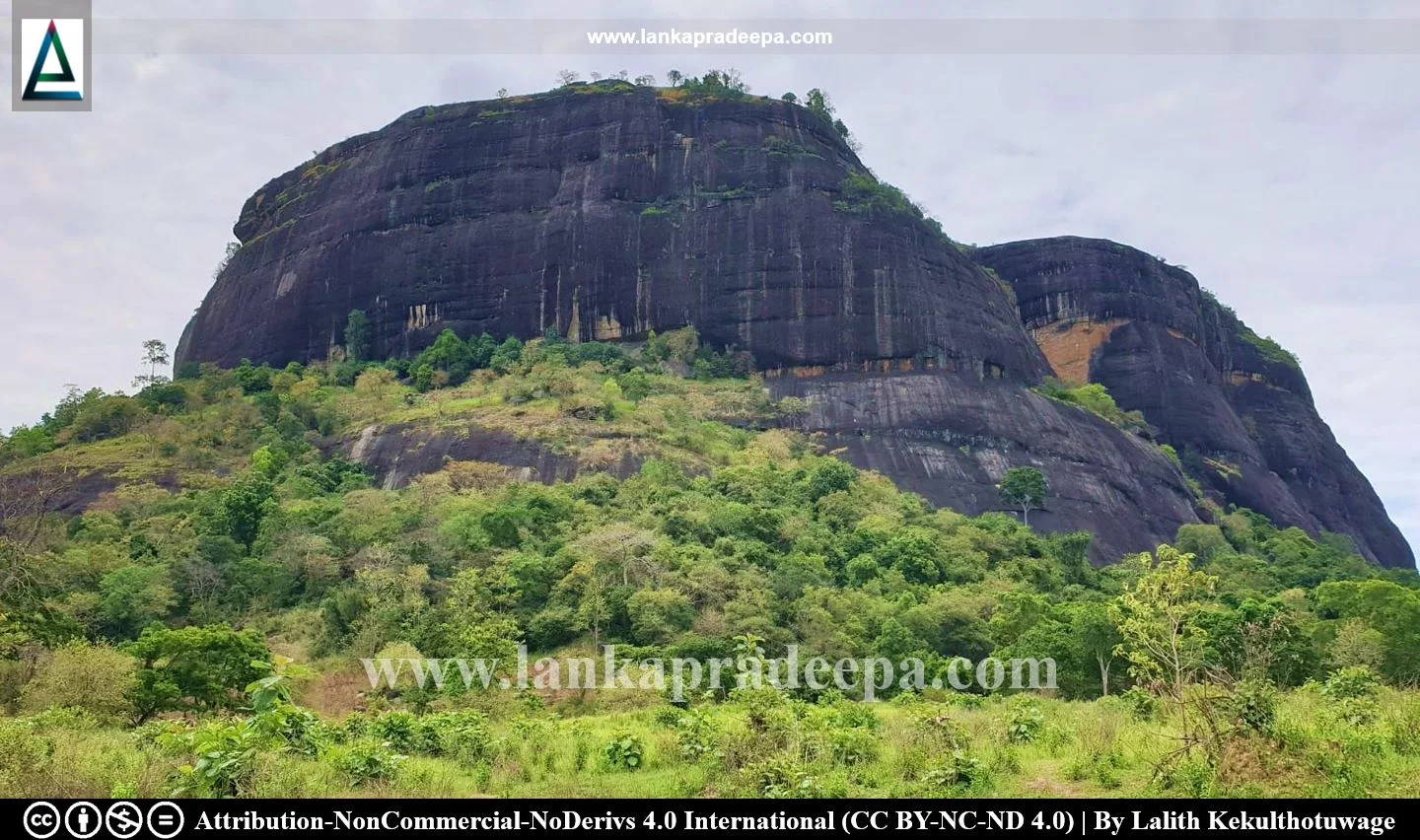
Nuwaragala (Sinhala: නුවරගල නටඹුන්) is a mountain with archaeological ruins situated southeast of Maha Oya town near Pollebedda village in Ampara District, Sri Lanka. Surrounded by other mountains such as Bambaragala (348 m), Mallutugala (431 m), Ethbeddagala (468 m) and Pethangala (332 m), Nuwaragala rises to an altitude of 332 meters (1,089.24 ft.) above mean sea level. Presently, the site is popular among travellers as a place for hiking and camping.
History
As the presence of several drip-ledged caves engraved with Early Brahmi Inscriptions on the summit of the rock, the history of this site can be back to the pre-Christian era or the early part of the Anuradhapura Period (Dias, 1991; Withanachchi, 2013). Two early Brahmi inscriptions of Sinhala Prakrit reveal that the caves at this site were used as dwellings of Buddhist monks (Dias, 1991; Nicholas, 1963; Paranavitana, 1970).
Nuwaragala Cave Inscription of Mahatissa
Period: 2nd century B.C Language: Old Sinhala Script: Early Brahmi
Transcript: Devanapiya-maharajaha Gamini-Tisaha puta Mahatisa-ayaha lene sagike
Translation: The cave of Prince Mahatissa, son of the great king Gamini Tissa, the Friend of the Gods, is the property of the Sangha.
References: Paranavitana, 1970. p.31.

This inscription has been engraved on the mouth of the main and largest cave (118 ft by 25 ft.) at the site where at least 100 people can gather at the same time (Lewis, 1907). It was discovered and first recorded by the British civil servant Hugh Nevill (1847-1897) in the "Taprobanian" Vol I (Parker, 1909). The record was republished in 1907 by F. Lewis in the Journal of the Ceylon Branch of the Royal Asiatic Society (Lewis, 1907; Parker, 1909). Scholars identify the son (Mahatisa) who left this inscription with Prince Lanjatissa (reigned 119-109 B.C.), the eldest son of King Saddhatissa (137- 119 B.C.) who is mentioned in the record by the name Gamini-tisa (Medhananda, 2003). There is a second cave at the site which once contained an inscription. Of this, only the words disha-shagasha are preserved (Paranavitana, 1970).
Besides the drip-ledged caves, the site is also dotted with ruins of ancient structures including the remains of a rampart and a large rock-cut pool (Medhananda, 2003; Withanachchi, 2013). In one place, there is a circular hole of about 7.5 inches in diameter drilled into the solid rock probably used as a socket for a mast or a signal post (Lewis, 1907). The rock-cut pond on the summit of the rock is 77 ft. 6 in. in length, 58 ft. 6 in. in width and about 5 ft. in depth (Lewis, 1907). To the southwest of the pond is the remains of a huge fort-like building with stone walls about 440 ft. long and 385 ft. wide (Lewis, 1907).
Due to fortification-like structures, scholars have tended to believe that Nuwaragala could be a military stronghold although there is evidence of an ancient Buddhist monastery (Lewis, 1907). The ruins of a massive irrigation project have been discovered at Rambakanthe Oya Reservoir site located about 5 km southwest of Nuwaragala mountain (Lewis, 1907).
The Pali Lalaṭadhatuwamsa and the Sinhala Dhatuwamsa mention a prince named Giri Abhaya who was the son-in-law of King Siva of Kelaniya and husband of Somadevi, the sister of Kavantissa [(2nd century B.C.) Medhananda, 2003]. Also, it tells us that the prince lived in his fortress Giri Nuwara (mountain city) and Prince Gemunu (reigned:161-137 B.C.), the brother of Saddhatissa (reigned: 137- 119 B.C.) and the son of Kavantissa visited this site with a minister named Dava (Medhananda, 2003). However, after an argument between the uncle and the nephew, Giri Abhaya left for Seru Nuwara abandoning his fortress (Medhananda, 2003). Some believe that Giri Nuwara in chronicles is the present Nuwaragala which also means the mountain city, but there is no other valid information to prove it (Medhananda, 2003).

.
Do you know?
Attribution
#) LankaPradeepa.com extends its gratitude to Lalith Kekulthotuwage for providing the necessary photographs required for this article. All the photos are published here with the permission of the author.
References
1) Dias, M., 1991. Epigraphical notes (Nos 1 -18). Colombo: Department of Archaeology. pp.25-26.
2) Lewis, F., 1907. Nuwara-gala, Eastern Province. The Journal of the Ceylon Branch of the Royal Asiatic Society of Great Britain & Ireland, 19(58), pp.142-153.
3) Medhananda, E., 2003. Pacheena passa - Uttara passa: Negenahira palata ha uturu palate Sinhala bauddha urumaya (In Sinhala). Dayawansa Jayakody & Company. Colombo. ISBN: 978-955-686-112-9. pp.270-272.
4) Nicholas, C. W., 1963. Historical topography of ancient and medieval Ceylon. Journal of the Ceylon Branch of the Royal Asiatic Society, New Series (Vol VI). Special Number: Colombo. Royal Asiatic Society (Ceylon Branch). p.32.
5) Paranavitana, S., 1970. Inscriptions of Ceylon: Volume I: Early Brahmi Inscriptions. Department of Archaeology Ceylon. p.31.
6) Parker, H., 1909. Ancient Ceylon: An account of the aborigines and of part of the early civilisation. Luzac & Co. London. pp.451-452.
7) Withanachchi, C. R., 2013. Pauranika Sthana Saha Smaraka: Ampara Distrikkaya (In Sinhala). Department of Archaeology (Sri Lanka). ISBN: 955-9159-44-5. p.31.
Explore Other Nearby Attractions
Location Map (Google)
This page was last updated on 14 September 2023

