Horton Plains National Park (Sinhala: හෝර්ටන් තැන්න ජාතික වනෝද්යානය; Tamil: ஓட்டன் சமவெளி தேசிய வனம்) is a national park situated in the Central Highlands of Sri Lanka.
Location
Situated in the south of the Nuwara Eliya District, it forms a plateau in the southeastern corner of the main ridge of Sri Lanka's central mountain massif (Rathnayake, 2015). It is the highest and largest plateau land located at an elevation ranging from 1,800 to 2,389 m above sea level, with a plateau starting from about 2,100 m above sea level (Chandrajith et al., 2009; Green, 1990). The Kirigalpotta (2,395 m) and Thotupola (2,357 m), the second and third highest mountain peaks in Sri Lanka are also located west and north of the Horton Plains respectively (Green, 1990; Premathilake, 2012). The area receives an annual rainfall ranging from 2,000 to 5,000 mm and has an average temperature that varies between 5-27°C (Chandrajith et
al., 2009).
Geology
The bedrock of the Horton Plains was formed during the Archaean and it mainly consists of highly metamorphic rocks belonging to the
charnokite-metasedimentary series, largely garne-tiferous gneisses, quartz and granulites (Premathilake & Risberg, 2003). An organic-rich soil layer covers the bedrock up to a height of about 1m (Premathilake & Risberg, 2003).
History
A pre-historic siteEvidence is there to prove that the area was occasionally inhabited by a prehistoric human population between 14,000 and 3000 14C years BP (Premathilake & Epitawatta, 2001; Premathilake & Nilsson, 2001). The first indications of human impact in Horton Plains are dated to around 14,000 BP and reflect forest clearance and grazing (Premathilake & Epitawatta, 2001). Stone tools associated with the Balangoda culture of prehistoric times have been identified in the area (Green, 1990; Pethiyagoda & Gunatilleke, 2006). The studies done by scholars have revealed possible evidence of cultivated rice (Oryza sp.) in Horton Plains around 13,000 B.C. and again between 8300 and 6500 B.C. (Premathilake, 2006) Evidence of the cultivation of Avena sp. (oat) and Hordeum sp. (barley) in around 11,000 B.C. have also been found (Premathilake, 2006).
Recent past
The plains have been named after Sir Robert Wilmot-Horton, the British governor of Ceylon from 1831 to 1837 (Pethiyagoda & Gunatilleke, 2006). It is said that there was a meeting on the plains between him and the Ratè Mahatteya (a chieftain) of Sabaragamuwa in 1836 (Green, 1990; Pethiyagoda & Gunatilleke, 2006).
The plains have been named after Sir Robert Wilmot-Horton, the British governor of Ceylon from 1831 to 1837 (Pethiyagoda & Gunatilleke, 2006). It is said that there was a meeting on the plains between him and the Ratè Mahatteya (a chieftain) of Sabaragamuwa in 1836 (Green, 1990; Pethiyagoda & Gunatilleke, 2006).
Between 1831 and independence in 1948, Horton Plains became hunting grounds for sambar and, to a lesser extent, elephant and wild boar (Green, 1990). Then, it remained largely intact until 1961, when the government decided to convert part of the grasslands into a potato farm under the Department of Agriculture (Pethiyagoda & Gunatilleke, 2006). About half of the open plains were under potato cultivation by 1977, but, with the pressure that arose from the conservationists, the scheme was finally abandoned (Green, 1990; Pethiyagoda & Gunatilleke, 2006). However, this caused some irreparable damage to the value of the site (Pethiyagoda & Gunatilleke, 2006)
To the World Heritage Site list
Horton Plains was first established as a Nature Reserve on 5 December 1969 and then upgraded to a National Park on 16 March 1988 (Green, 1990; Pethiyagoda & Gunatilleke, 2006; Premathilake, 2012; Rathnayake, 2015). In 2010, it was included in the UNESCO World Heritage Site list as a part of the Central Highlands of Sri Lanka (UNESCO Ref: 1203).
Forest die-back
Red Bridge:
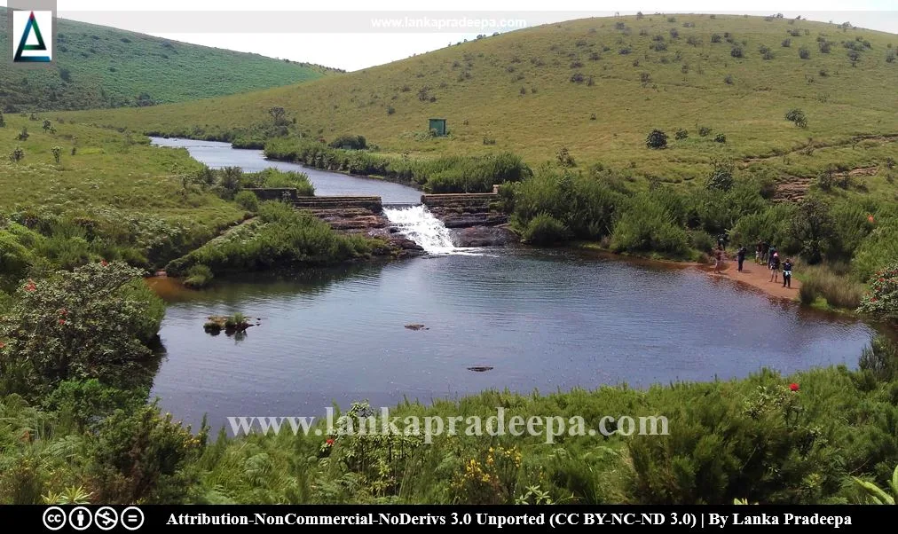
Chimney Pool: This is a man-made water body that resembles the shape of a chimney lamp.
To the World Heritage Site list
Horton Plains was first established as a Nature Reserve on 5 December 1969 and then upgraded to a National Park on 16 March 1988 (Green, 1990; Pethiyagoda & Gunatilleke, 2006; Premathilake, 2012; Rathnayake, 2015). In 2010, it was included in the UNESCO World Heritage Site list as a part of the Central Highlands of Sri Lanka (UNESCO Ref: 1203).
Super Bio-diversity Hotspot
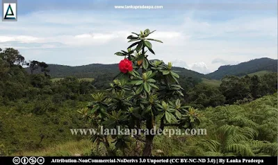
Horton Plains is considered one of the most important montane ecosystems in the country (Chandrajith et al., 2009). Extending in an area of about 3162 ha,, it comprises pigmy, open & dense forests, streams & waterfalls, hilltops, grassy slopes, precipices, grasslands, marshes, etc. (Chandrajith et al., 2009; Premathilake & Risberg, 2003; Premathilake, 2012; Rathnayake, 2015). It is a super biodiversity hotspot with exceptional endemism and most of the fauna and flora found here are endemic to the country (Chandrajith et al., 2009; Rathnayake, 2015). The vegetation consists of upper montane rainforests and grasslands (Premathilake & Nilsson, 2001). Totally, 57 woody species belonging to 31 families have been encountered whereof 50% of the plant species identified in the area are only found in Sri Lanka (Premathilake & Nilsson, 2001; Premathilake & Risberg, 2003). The Horton Plains are the headwaters of major rivers in the country such as the Mahaweli, Kelani, and Walawe (Green,
1990; Premathilake, 2012).
Forest die-back
Forest dieback is one of the major threats faced by Horton Plains
(Chandrajith et al., 2009). It was observed that 17.2% of forested areas in the national park have been subjected to severe dieback (Ranawana, 1999). Although some factors have been identified, no conclusive evidence has been found yet on the aetiology of the die-back of forests (Chandrajith et al., 2009).
Tourism
Horton Plains is a popular tourist destination. Visitors are allowed to walk in the park along two nature trails; Baker's Fall (6 km) and World's End (4km). The red bridge, chimney pool, Baker's Fall, and Small and Greater World's Ends are the most attractive places found on the Horton Plains (Rathnayake, 2015).
Red Bridge:
The bridge at the beginning of the Baker's Fall trail is called the "Red Bridge". The stream that flows beneath the bridge constitutes the uppermost reaches of the Belihul Oya, a tributary of the Walawe Ganga River (Rathnayake, 2015).
Chimney Pool: This is a man-made water body that resembles the shape of a chimney lamp.
Baker's Fall:
An attractive waterfall of about 20m tall.
Small & Great World' Ends: Situated at the southern boundary of the Horton Plains, these two precipices are locally called the Punchi Lokanthaya (the Small World's End) and the Maha Lokanthaya (the Greater World's End). The two locations are situated about 0.8 km away from each other.
 .
.References
1) Chandrajith, R., Koralegedara, N., Ranawana, K.B., Tobschall, H.J. and Dissanayake, C.B., 2009. Major and trace elements in plants and soils in Horton Plains National Park, Sri Lanka: an approach to explain forest die back. Environmental geology, 57(1), pp.17-28.
2) Green, M.J.B. ed., 1990. IUCN directory of South Asian protected areas. IUCN. pp.216-220.
3) Pethiyagoda, R. and Gunatilleke, C.V.S., 2006. Horton Plains. International Field Biology Course 2006. Center for Tropical Forest Science – Arnold Arboretum Asia Program, University of Peradeniya & Forest Department Sri Lanka. pp.25-26.
4) Premathilake, R., 2006. The emergence of early agriculture in the Horton Plains, central Sri Lanka: linked to late Pleistocene and early Holocene climatic changes. In First Farmers in Global Perspective” Conference.
5)Premathilake, R., 2012. Human used upper montane ecosystem in the Horton Plains, central Sri Lanka–a link to Lateglacial and early Holocene climate and environmental changes. Quaternary Science Reviews, 50, pp.23-42.
6) Premathilake, R. and Nilsson, S., 2001. Pollen morphology of endemic species of the Horton Plains National Park, Sri Lanka. Grana, 40(6), pp.256-279.
7) Premathilake, T.R. and Epitawatta, D.S., 2001. Late Quaternary Vegetation, Climate and Land-use History of the Horton Plains, Central Sri Lanka. Vidyodaya J. of Sci. (2001) Vol. 10. pp.1-20
8) Premathilake, R. and Risberg, J., 2003. Late Quaternary climate history of the Horton plains, central Sri Lanka. Quaternary Science Reviews, 22(14), pp.1525-1541.
9) Ranawana, K.B., 1999. Damage by herbivores, seedling regeneration and extent of die back. Final report-Horton Plains forest die back research project, University of Peradeniya, pp 123–145.
10) Rathnayake, R.M.W., 2015. How does ‘crowding’ affect visitor satisfaction at the Horton Plains National Park in Sri Lanka?. Tourism Management Perspectives, 16, pp.129-138.
Location Map
This page was last updated on 23 July 2023


