
|
Mahaweli Ganga River |
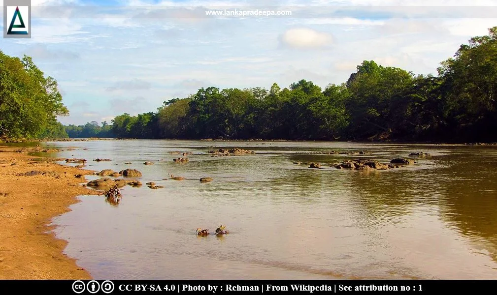
Mahaweli Ganga (Sinhala: මහවැලි ගඟ; Tamil: மகாவலி ஆறு) is the longest and largest river system in Sri Lanka (Arumugam, 1969). It is 335 km long and is longer than the combined length of any other two rivers in the country (Bandara, 1985; Vithanage, 1988). It conveys the largest volume of water in Sri Lanka amounting to one-seventh of the total runoff (Hewavisenthi, 1997).
The headstreams of the river originate at altitudes of over 1,340 m above sea level and they form the main river before it flows through lowland plains and enters the Indian Ocean through Koddiyar Bay, south of Trincomalee (Bandara, 1985). The Dick Oya, Dambagastalawa Oya, Agra Oya and Nanu Oya originate in Marlborough estate, Ambawela hills, Horton Plains and Pidurutalagala respectively are the four streams that form the river (Arumugam, 1969). Dambagastalawa Oya flows into Agra Oya and these two meet Nanu Oya at Talawakelle to form Kotmale Oya (Arumugam, 1969). Dick Oya meet Kotmale Oya at Mahavilla (Arumugam, 1969).
History
The landing place of Panduvasudeva in the 5th century B.C. is given in chronicles as Gokannatittha (present Trincomalee) at the mouth of the Mahakandara river; therefore, Mahakandara is another name for Ganga or Mahaganga or Mahavaluka Ganga, the present Mahaweli Ganga (Nicholas, 1963). The river was the boundary between Rajarattha and Rohana during the Anuradhapura Period (Nicholas, 1963). The fords and forts along the lower course of Mahaweli Ganga are mentioned in detail in the chronicle Mahavamsa in connection with Prince Dutthagamani's war with King Elara in the 2nd century B.C. and again during the civil war in the 12th century which preceded the accession of Parakramabahu I [(1153-1186 A.D.) Nicholas, 1963].
King Aggabodhi I (575-608 A.D.) developed the Manimekhala Dam, an anicut across the Mahaweli Ganga river at Minipe (Arumugam, 1969; Nicholas, 1963). The Kingdom of Gampola was known as "Ganga Siri Pura" due to its environmental association with the Mahaweli Ganga River (De Silva, 1990).
River Basin
The Mahaweli Ganga river basin extending in an area of about 10,320 km2 is equivalent to 15% of the country’s land area and is the largest river basin (Dissanayake & Weerasooriya, 1986; Diyabalanage et al., 2016; Hewavisenthi, 1997). The annual discharge of the river is about 8.4 billion cubic meters which is used to irrigate over 140,000 ha of land in downstream areas (Diyabalanage et al., 2016).
Major tributaries of Mahaweli Ganga
-
1) Kotmale Oya
2) Uma Oya
3) Badulu Oya
4) Loggal Oya
5) Heppola Oya
6) Ulhitiya Oya
-
7) Hulu Ganga
8) Hassalak Oya
9) Heen Ganga
10) Amban Ganga
11) Kalu Ganga
12) Kaudulla Oya
Major irrigation and development schemes in the Mahaweli Ganga basin
-
1) Badulu Oya Scheme
2) Sorabora Wewa Scheme
3) Damparawa Wewa Scheme
4) Mapakada Wewa
5) Bathmedilla Scheme
6) Allai Scheme
7) Minneriya Wewa
8) Giritale Scheme
9) Parakrama Samudra Scheme
10) Elahera Scheme
-
11) Kaudulla Scheme
12) Minipe Extension Scheme
13) Haththota Amuna
14) Nalanda Oya Reservoir Diversion Scheme
15) Polgolla Diversion Anicut
16) Moragahakanda Scheme
17) Victoria Scheme
18) Randenigala Scheme
19) Rantembe Scheme
20) Kotmale Reservoir Scheme
Mahaweli Development Programme
In the 1960s, a Master Plan for the development of water resources of the Mahaweli Ganga river basin was formulated by the United Nations Development Programme (UNDP) and the Food and Agriculture Organization [(FAO) Hewavisenthi, 1997]. It included the construction of multipurpose reservoirs, the development of irrigation infrastructure in new areas, and the improvement of existing irrigation infrastructure (Hewavisenthi, 1997). The programme was carried out stepwise over more than 30 years making it the largest multipurpose national development program in Sri Lankan history. Under this project, the surplus water of the Mahaweli Ganga River was diverted into the adjacent river basins of Kala Oya, Malwatu Oya, Yan Oya and Maduru Oya.
Related Posts
Read Also
References
Books, Journal Articles
1) Arumugam, S., 1969. Water resources of Ceylon: its utilisation and development. Water Resources Board. pp.203-207.
2) Bandara, M., 1985. The Mahaweli strategy of Sri Lanka, great expectation of a small nation. In Strategies for river basin management. Springer, Dordrecht. pp. 265-277.
3) De S. Hewavisenthi, A.C., 1997. Management of the Mahaweli, a river in Sri Lanka. Water international, 22(2), pp.98-107.
4) De Silva, N., 1990. Sri Lankan architecture during the period 1200-1500 A.D. Wijesekara, N. (Editor in chief). Archaeological Department centenary
(1890-1990): Commemorative series: Volume III: Architecture. Department of Archaeology (Sri Lanka). p.77.
5) Dissanayake, C.B. and Weerasooriya, S.V.R., 1986. The environmental chemistry of Mahaweli river, Sri Lanka. International journal of environmental studies, 28(2-3). pp.207-223.
6) Diyabalanage, S., Abekoon, S., Watanabe, I., Watai, C., Ono, Y., Wijesekara, S., Guruge, K.S. and Chandrajith, R., 2016. Has irrigated water from Mahaweli River contributed to the kidney disease of uncertain etiology in the dry zone of Sri Lanka?. Environmental Geochemistry and Health, 38(3), pp.679-690.
7) Nicholas, C. W., 1963. Historical topography of ancient and medieval Ceylon. Journal of the Ceylon Branch of the Royal Asiatic Society, New Series (Vol VI). Special Number: Colombo. Royal Asiatic Society (Ceylon Branch). pp.36,43-44.
8) Vithanage, P.W., 1988. Relief and Drainage. The National Atlas of Sri Lanka. Survey Department of Sri Lanka. ISBN: 9559059009. pp.22-23.
Location Map
Dynamic Google Map
Attribution
To Whom
1) WasgamuwaNationalPark-September2014 (7) by Rehman is licensed under CC BY-SA 4.0

.JPG)