|
Photo caption |
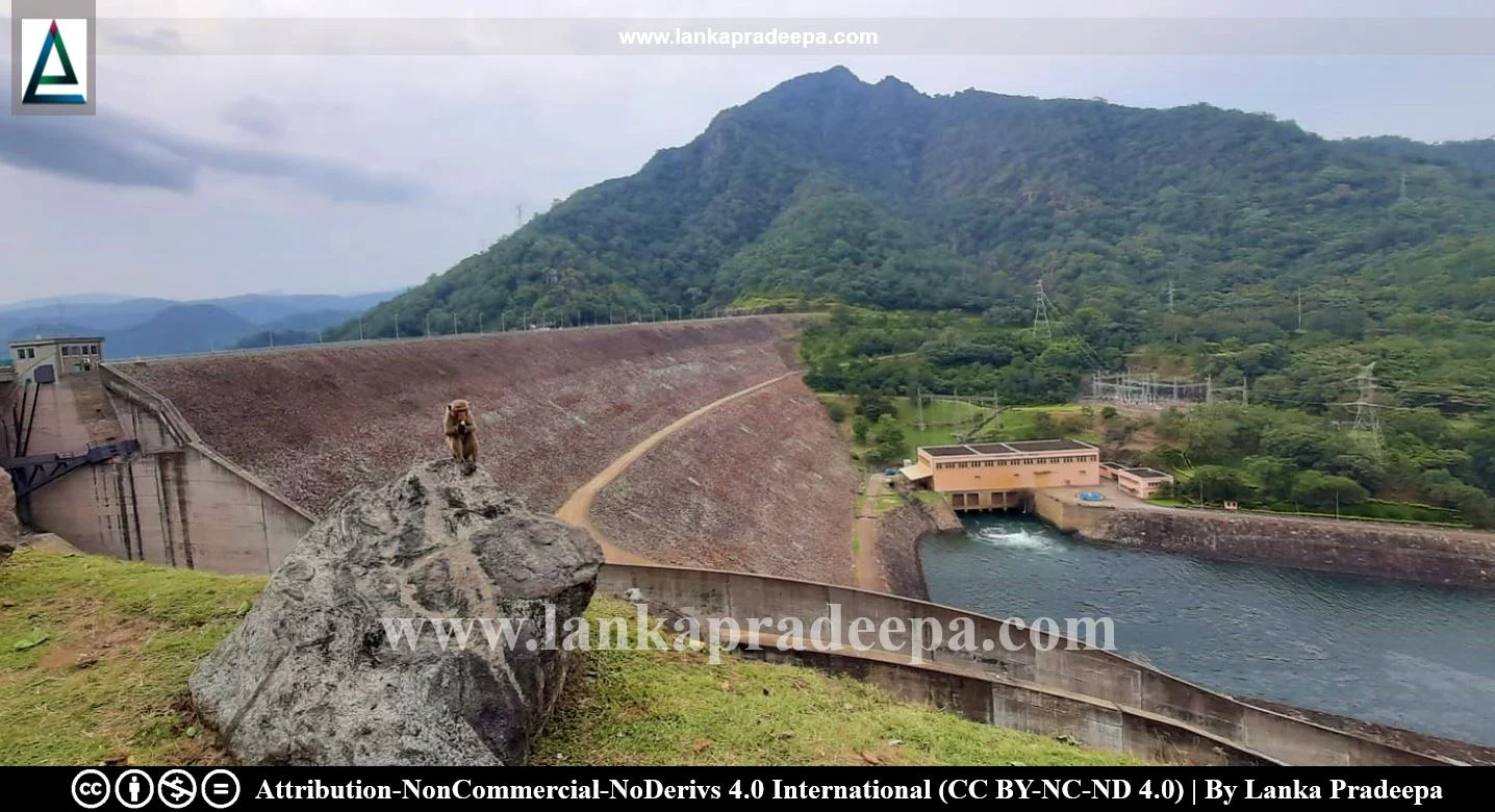
Randenigala Reservoir (Sinhala: රන්දෙණිගල ජලාශය), is a major reservoir situated within Victoria Randenigala Rantembe Sanctuary in Central Province, Sri Lanka. It has the highest capacity out of the other reservoirs within the Upper Mahaweli Catchment reservoir chain namely Kotmale, Victoria and Rantambe (Senadeera, 2016).
History
The reservoir was constructed by starting the damming of the Mahaweli Ganga River under the Accelerated Mahaweli Development Project in 1982 to be used for hydroelectric power generation and irrigation (Manage & Piyasiri, 2015). Built closer to the old Minipe Anicut, the impounding of the reservoir was done in March 1986 (De S. Hewavisenthi, 1992).
The project was financially supported by the Government of West Germany (Dissanayake, 2016).
Dam and Reservoir
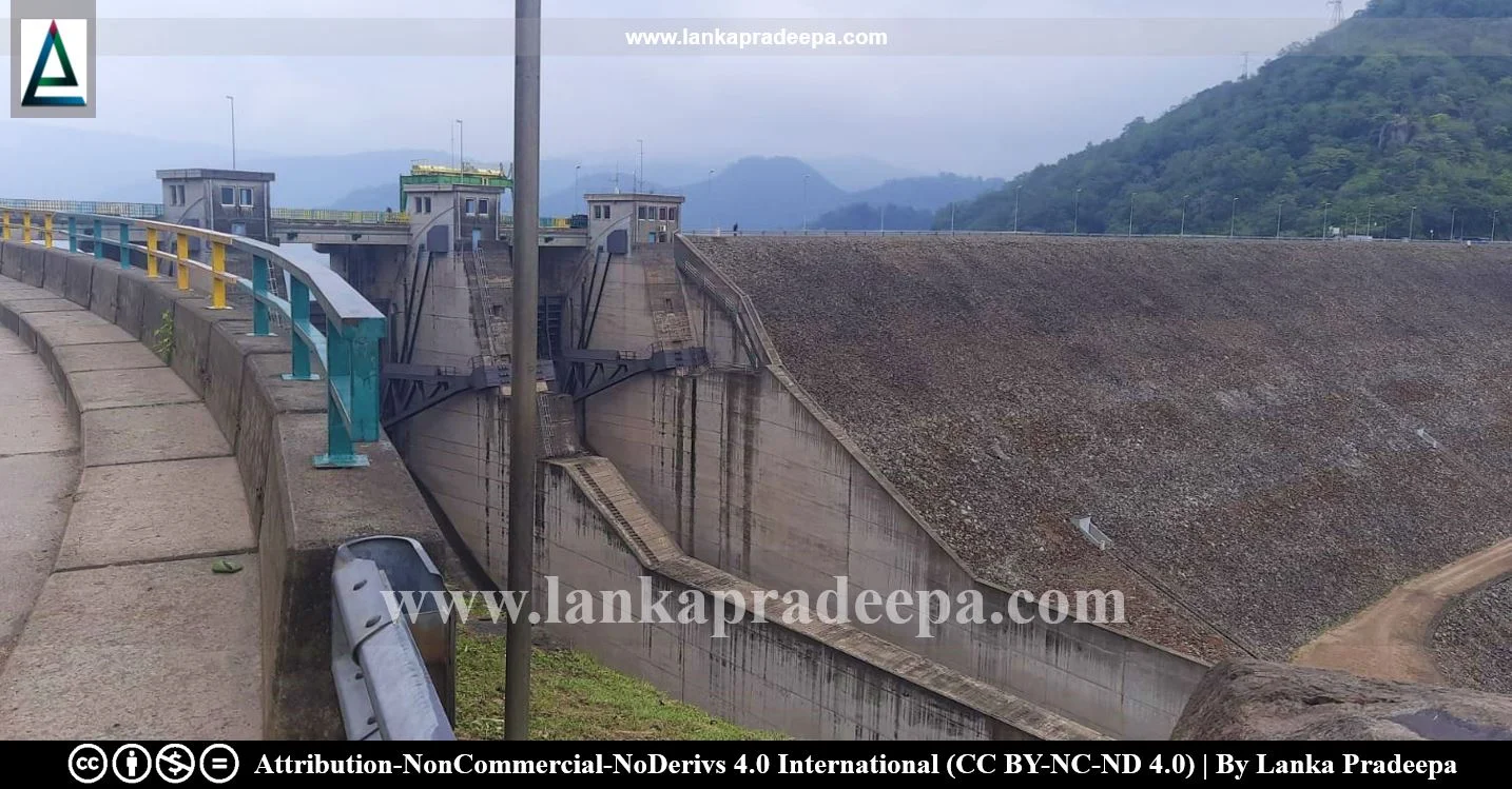
The Randenigala Dam which is a rockfill dam with a central clay core is situated about 20 km downstream from the Victoria Dam (De S. Hewavisenthi, 1992). The dam has a length of 485 m and a height of 94 m (Dissanayake, 2016).
Located at an elevation of 160 m to 240 m, the reservoir storage capacity is 861.4 MCM (Senadeera, 2016). The upstream dam site of the reservoir comprises 448 km² in the districts of Kandy and Nuwara Eliya (Senadeera, 2016). The shoreline length is 74 km and the mean depth (Z= V/A) is 36.6 m (Manage & Piyasiri, 2015). The maximum length of the reservoir is 1.6 km while the maximum width is 1.2 km (Manage & Piyasiri, 2015).
After generating hydropower, the outflow of the Victoria Reservoir enters the Randenigala Reservoir via the Mahaweli Ganga River which is the major source of water. Therefore, the water level of the reservoir is mostly controlled by the outflow of the Victoria Reservoir (De Silva & De Silva, 1991). Besides the Mahaweli Ganga River, the reservoir is also fed by several tributaries namely Ma Oya, Unagolla Kanda Oya, Kehelella Ela and Medagama Oya (Manage & Piyasiri, 2015; Senadeera, 2016). The catchment area of the reservoir is fully covered by the forest and its elevation ranges from 240 m to 2,500 m at Pidurutalagala Mountain Range.
Power Station
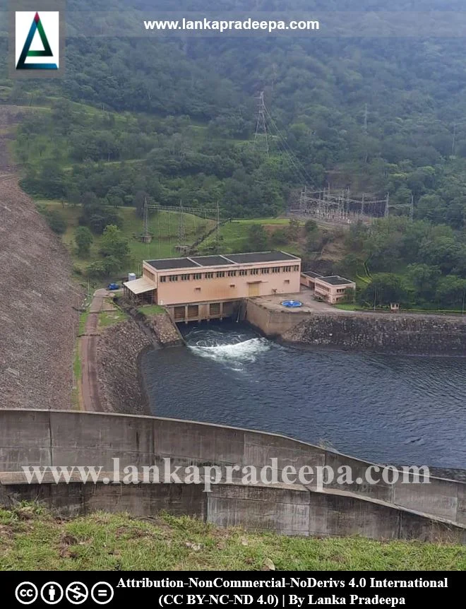
The Randenigala power station is located immediately downstream of the dam, on the left bank. The station consists of two generators with a rated capacity of 61 MW each (De S. Hewavisenthi, 1992). The average annual energy production is 302 GWh (De S. Hewavisenthi, 1992).
Environmental Impact
The reservoir is located within the Victoria Randenigala Rantembe Sanctuary which is considered the largest sanctuary in Sri Lanka (Nissanka & Mapa, 2001). Certain areas in the Rantambe catchment are said to have been disturbed by the construction of the Randenigala dam in 1987 with no planned rehabilitation programme (Nissanka & Mapa, 2001). Also, the irrational land use practices in upper catchment areas cause extensive soil erosion resulting in loss of fertile soil and siltation of the reservoir. Fishing is also prohibited in Randenigala Reservoir as it is situated within the boundaries of a wildlife sanctuary. However, illegal fishing has been continuing since the year of its impoundment (De Silva & De Silva, 1991).


Related Posts
Read Also
References
Journal Articles
1) De S. Hewavisenthi, A.C., 1992. Mahaweli water resources project. Water international, 17(1), pp.33-43.
2) De Silva, K.H.G.M. and De Silva, P.K., 1991. The role of Tilapia species (family cichlidae) in the fishery of three upland, deep reservoirs of Sri Lanka. Vidyodaya Journal of Science, 3(1). pp.91-98.
3) Dissanayake, N.K.M., 2016. Evaluating new towns in the context of mega projects: a case study of the Mahaweli Architectural Unit, Sri Lanka (1983-1989) (Doctoral dissertation). pp.25-26.
4) Manage, P.M. and Piyasiri, S., 2015. The Chlorophyll-a content, species composition and population structure of phytoplankton in Randenigala reservoir in Sri Lanka. Vidyodaya 1. of Sci., Vol. 5. No. 1. pp.29-41.
5) Nissanka, S.P. and Mapa, R.B., 2001. Changes in vegetation and soil characteristics of regenerating forest at Randenigala. In Proceedings of International Forestry and Environment Symposium. Department of Forestry and Environmental Science, Universlty of Sri Jayewardenepura. p.37.
6) Senadeera, W., 2016. Morphmetric analysis of Randenigala reservoir catchment using GIS. International Journal of Multidisciplinary Studies (IJMS) Volume I, Issue II. pp.75-82.
Location Map
Dynamic Google Map
Attribution
To Whom
1) RandenigalaDam-December2013-10 by Rehman is licensed under CC BY-SA 4.0

