|
Victoria Reservoir |
Victoria Reservoir (Sinhala: වික්ටෝරියා ජලාශය; Tamil: விக்டோரியா அணை) is a hydroelectric and irrigation reservoir in Kandy District, Sri Lanka. It has been named in honour of Queen Victoria, Empress of the British Empire.
History
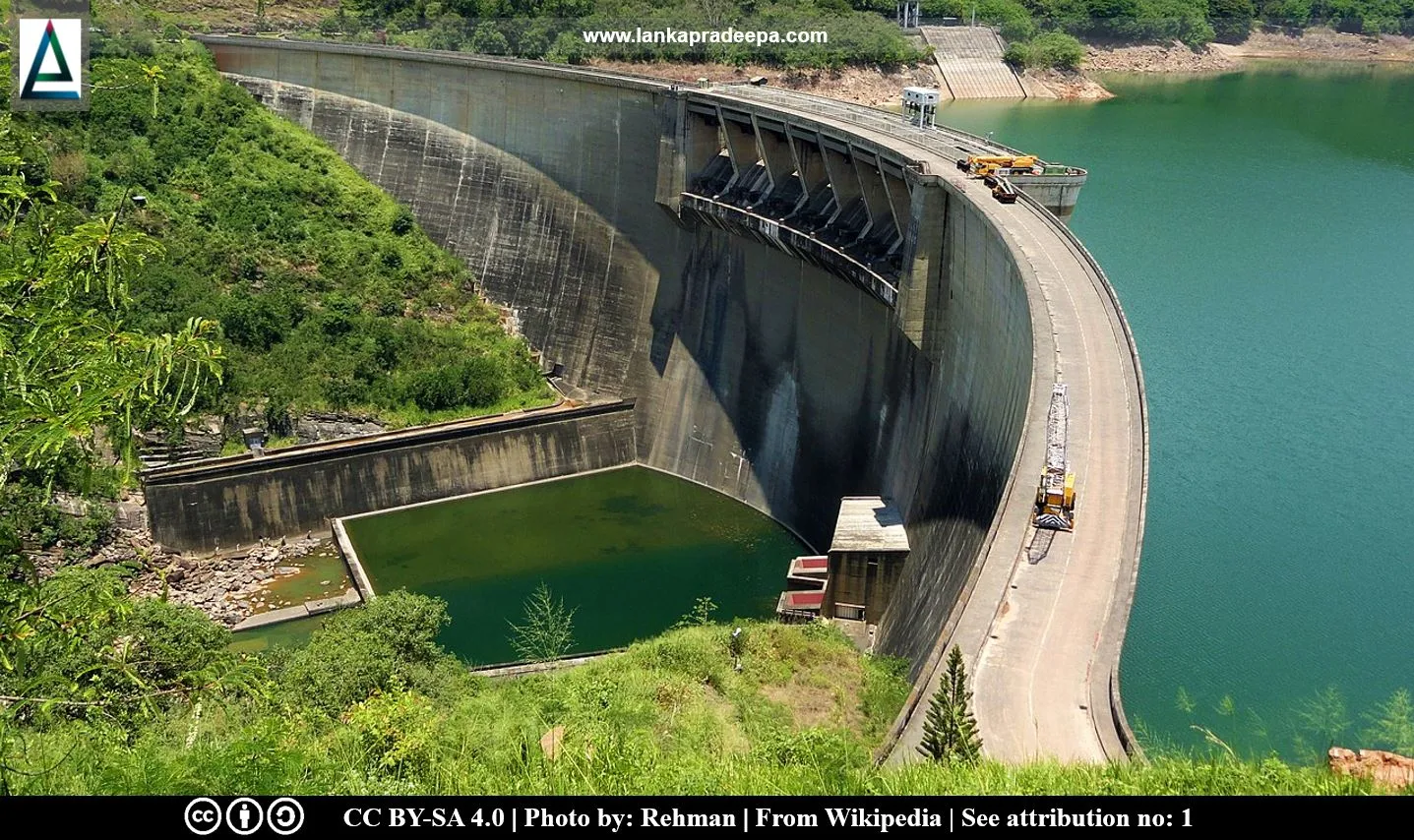
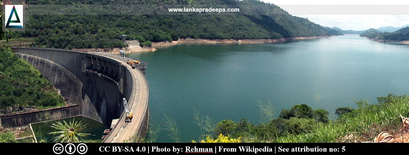
Victoria Reservoir was built as a major component of the multi-purpose Accelerated Mahaweli Development Project which envisaged the construction of a series of reservoirs along the Mahaweli Ganga River, the longest river in the country to develop and irrigate a land area of 212 km² and generate 210 MW of hydroelectricity (Herath et al., 2022). The reservoir was constructed by damming the trunk stream of the Mahaweli Ganga River in the Central Highlands with a double-curvature concrete arch dam at Victoria Falls located near the confluence of the Hulu Ganga and Mahaweli Ganga Rivers (Silva et al., 2008).
The project was financially supported by the Government of the United Kingdom (Dissanayake, 2016; Madduma Bandara, 1985). In 1978, the British Government allocated grant aid of £ l00 million (later increased to £ 113 million) for the construction of the project (Back & Mee, 1991). The dam was completed in January 1984 and became operational by mid of that year (De Silva, 1991; Dissanayake, 2016; Wijesundara & Dayawansa, 2011). The reservoir was ceremonially opened by the Prime Minister of the United Kingdom, Margaret Thatcher on 12 April 1985 (Dissanayake, 2016).
Dam and Reservoir

Situated 300 m below the confluence of the Hulu Ganga and just above the Victoria rapids on the Mahawali Ganga River, the double-curvature Victoria Dam has a crest length of 525 m and a maximum height of 122 m above the foundation (Back & Mee, 1991; Dissanayake, 2016; Herath et al., 2022; Wijesundara & Dayawansa, 2011).
The reservoir has a total catchment area of 1869 km² with a gross capacity of 728 Mm³ and an active storage capacity of 698 Mm³ that is able to generate 780 GWh per year (Herath et al., 2022). The entire catchment lies in the Central Highlands of the Mahaweli Ganga River basin and on the southwestern slopes of the Knuckles Mountain Range (Silva et al., 2008).
Power Station
Victoria is exclusively a hydropower reservoir with an installed capacity of 3x70 MW (Silva et al., 2008).
Environmental-social Impact
The construction of Victoria Reservoir inundated 1,925 hectares of land, including agricultural lands as well as a total of nearly 29 km of roads (Wijesundara & Dayawansa, 2011). A survey revealed that the project affected some 283 villages while submerging a major township in the area (Madduma Bandara, 1985).


Related Posts
Read Also
References
Journal Articles
1) Back, P.A.A. and Mee, W.T., 1991. The Victoria Project, Sri Lanka: Project planning and design of Victoria Dam. Proceedings of the Institution of Civil Engineers, 90(2), pp.281-311.
2) De Silva, K.H.G.M., 1991. Growth rate and the role of Oreochromis mossambicus (Peters) in the fishery of a tropical, upland, deep reservoir in Sri Lanka. Fisheries research, 12(2), pp.125-138.
3) Dissanayake, N.K.M., 2016. Evaluating new towns in the context of mega projects: a case study of the Mahaweli Architectural Unit, Sri Lanka (1983-1989) (Doctoral dissertation). pp.25-26.
4) Herath, P., Attanayake, J. and Gahalaut, K., 2022. A reservoir induced earthquake swarm in the Central Highlands of Sri Lanka. Scientific Reports, 12(1), p.18251.
5) Madduma Bandara, C.M., 1985. The Mahaweli strategy of Sri Lanka—great expectation of a small nation. In Strategies for River Basin Management: Environmental Integration of Land and Water in a River Basin (pp. 265-277). Dordrecht: Springer Netherlands.
6) Silva, E.I.L., Simon, D. and Schiemer, F., 2008. Catchment characteristics, hydrology, limnology and socio-economic features of three reservoirs in Sri Lanka. Aquatic Ecosystems and Development: Comparative Asian Perspectives (F. Schiemer, D. Simon, US Amarasinghe and J. Moreau eds), pp.20-43.
7) Wijesundara, C.J. and Dayawansa, N.D.K., 2011. Construction of large dams and their impact on cultural landscape: a study in Victoria reservoir and the surrounding area.
Location Map
Dynamic Google Map
Attribution
To Whom
1) VictoriaDam-SriLanka-April2011-1 by Rehman is licensed under CC BY-SA 4.0
2) PowerstationOfVictoriaDam-SriLanka-April2011-1 by Rehman is licensed under CC BY-SA 4.0
3) VictoriaDam-SriLanka-April2011-2 by Rehman is licensed under CC BY-SA 4.0
4) VictoriaDam-SriLanka-April2011-3 by Rehman is licensed under CC BY-SA 4.0
5) VictoriaDam-SriLanka-April2011-4 by Rehman is licensed under CC BY-SA 4.0

