
|
Photo caption |
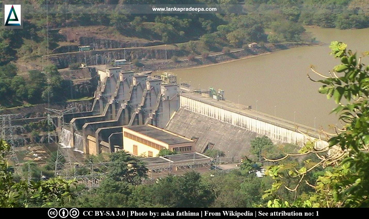
Rantembe Reservoir (Sinhala: රන්ටැඹේ ජලාශය) is a reservoir in Central Province, Sri Lanka. Located between the Randenigala Dam and the Minipe Anicut, it is the lowermost reservoir on the Mahaweli cascade.
History
Rantembe Reservoir was built as a component of the multi-purpose Mahaweli Development Project which envisaged the construction of a series of reservoirs along the Mahaweli Ganga River, the longest river in the country. The reservoir was built by constructing a dam at the point where the right bank tributary, Uma Oya joined the Mahaweli Ganga River (De S. Hewavisenthi,, 1992). The construction work of the project was commissioned on 23 March 1986 and the power complex was commissioned on 26 May 1990.
Dam and Reservoir
The Rantembe Dam which is a concrete gravity dam is 420 m in length and 41.5 m in height (De S. Hewavisenthi,, 1992; Udayakumara & Gunawardena, 2022). The reservoir has a catchment area of 3,113 km² and a total capacity of 21 Mm³ (De S. Hewavisenthi, 1992). The surface area of the reservoir is 1.3 km² and the average depth is 8.6 m. (Wasala et al., 2022). It has two bottom outlets, each of 2.55 m width and 3.60 m height, (Gunasinghe et al., 2019). The main sources of water for the reservoir are the Uma Oya River and the Mahaweli Ganga River which flows from the Randenigala Reservoir built across the river upstream (Wasala et al., 2022).
Rantembe Reservoir's primary function is the generation of hydroelectricity using the water discharged from the Randenigala Reservoir (Gunasinghe et al., 2019). The reservoir is also important as it regulates the outflows of Randenigala and Uma Oya to reduce water level fluctuations at the Minipe weir located downstream (De S. Hewavisenthi,, 1992).
Power Station
The Rantembe power station is located at the toe of the dam on the left bank with two turbine-generator units (2x26 MW) of total installed capacity of 52 MW (De S. Hewavisenthi,, 1992; Udayakumara & Gunawardena, 2022).


Related Posts
Read Also
References
Journal Articles
1) De S. Hewavisenthi, A.C., 1992. Mahaweli water resources project. Water International, 17(1), pp.33-43.
2) Gunasinghe, A.R.P., Weerasinghe, H.P.D.A. and Weerakoon, S.B., 2019. Sediment Flushing Arrangements for Rantambe Hydropower Reservoir Analyzed by Two-Dimensional Hydrodynamic Modelling. 10th International Congress of Environmental Research (ICER-19): Kalady, India.
3) Udayakumara, E.P.N. and Gunawardena, P., 2022. Modelling soil erosion and hydropower linkages of Rantambe reservoir, Sri Lanka: towards payments for ecosystem services. Modeling Earth Systems and Environment, 8(2), pp.1617-1634.
4) Wasala, W.M.D.M., Rathnasiri, R.M.C.B. and Weerakoon, S.B., 2022. Two—Dimensional Modelling of Flow in Rantambe Reservoir for Sediment Management. In ICSBE 2020: Proceedings of the 11th International Conference on Sustainable Built Environment (pp. 649-656). Springer Singapore.
Location Map
Dynamic Google Map
Attribution
To Whom
1) Dam in Sri Lanka - 2011 (1553) by aska fathima is licensed under CC BY-SA 3.0
2) RantembeDam-December2013-1 by Rehman is licensed under CC BY-SA 4.0
3) RantembeReservoir-December2013-1 by Rehman is licensed under CC BY-SA 4.0

.jpg)