|
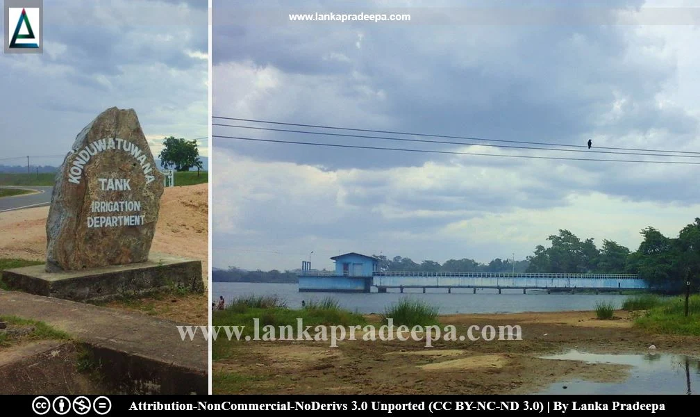
Konduwatuwana Wewa |
Konduwatuwana Wewa (also written as Kondavattavan or Kandewattavana Tank, Sinhala: කොණ්ඩුවටුවාන වැව/ කොණ්ඩුවටුවාන ජලාශය) is a reservoir situated in Ampara District, Sri Lanka. It is surrounded by Ampara Wewa to the east, Himidurawa Wewa to the west and Buddhangala Sanctuary to the north.
History
The Reservoir
The present reservoir is said to have been constructed under the Pattipola Aru Scheme; now incorporated in the Gal Oya Scheme (Arumugam, 1969). It was restored in 1912 (Arumugam, 1969).
Archaeological Ruins
A site with the ruins of an ancient Buddhist monastery is found within the premises of the Sri Lanka Army Combat Training School located near the Konduwatuwana reservoir. Ruined buildings with stone pillars, old bricks, Siripatula stones, and inscriptions are found among the ruins (Medhananda, 2003; Vithanachchi, 2013). The circular stone slab containing a mark of Siripatula (Pada-lanchana-gala) is considered a rare artefact (Medhananda, 2003). The diameter of this stone is 2 ft 6 in and the print of Siripatula has been carved in the middle of it (Medhananda, 2003).
There are also some sites around the Konduwatuwana reservoir with archaeological ruins including inscriptions (Vithanachchi, 2013). These ruined sites may or may not have formed a single monastery in ancient times (Nicholas, 1963). Two Later Brahmi Inscriptions have been discovered engraved on a boulder in the bed of the Konduwatuwana reservoir (Paranavitana, 2001). Of them, one records the grant of the tank of Hajamatavika to the community of Buddhist monks of Alarama monastery by a minister named Butaya (Paranavitana, 2001). The other inscription which belongs to the 2nd century A.D. states that the three hundred Karisas of the tank Vahabavi belonged to the monastery of Ahali-araba (Dias, 1991; Paranavitana, 2001). According to Paranavitana, the two names Alarama and Ahali-araba both go back most probably to an original form Ahali-arama (Paranavitana, 2001).
Konduwatuwana Pillar Inscription
A pillar containing a Sinhala inscription dated in the 10the regnal year of King Dappula IV (923-935 A.D.) was discovered near the Konduwatuwana reservoir in 1953 (Nicholas, 1963; Ranawella, 2004). It records certain immunities granted by the king in respect of a village named "Äragama" (present Konduwatuwana) located in the region of "Metera-Digamandulla", the revenue of which were enjoyed at the time by a Senevirad (a Commander-in-Chief) named Dandanayaka Sangva Rakus (Nicholas, 1963; Ranawella, 2004). It also contains certain regulations regarding the revenue and judicial administration of that village (Ranawella, 2004).
Reservoir
The reservoir is located in the Gal Oya River basin. Except for the drainage from its own catchment area, a channel from Himidurawa Wewa supplies water to the Konduwatuwana reservoir (Arumugam, 1969). In the late 1960s, the length of the bund of the reservoir was 4,500 ft. and the water was extending in an area of about 880 acres at its full supply level (Arumugam, 1969). The present reservoir has 1 sluice and 2 spills and supplies water to the nearby Ampara Wewa and to Walathapitiya Wewa (Arumugam, 1969).
A Protected Site
The place with the ruins of ancient buildings in the area called Konduwatuwan belonging to Govikandawura village situated in Grama Niladhari Division No. W/86/K 060 Kotawehera in the Divisional Secretary’s Division Ampara is an archaeological protected site, declared by a government gazette notification published on 10 October 2014.

|
Ruins within the premises of Army Combat Training School |
Related Posts
Read Also
References
Books, Government Gazette Notifications, Journal Articles
1) Arumugam, S., 1969. Water resources of Ceylon: its utilisation and development. Water Resources Board. p.168.
2) Dias, M., 1991. Epigraphical notes (Nos 1 -18). Colombo: Department of Archaeology. pp.45,47.
3) Medhananda, Ven. Ellawala, 2003. Pacheena passa - Uttara passa: Negenahira palata ha uturu palate Sinhala bauddha urumaya (In Sinhala).
Dayawansa Jayakody & Company. Colombo. ISBN: 978-955-686-112-9. p.179.
4) Nicholas, C. W., 1963. Historical topography of ancient and medieval Ceylon. Journal of the Ceylon Branch of the Royal Asiatic Society, New Series (Vol VI). Special Number: Colombo. Royal Asiatic Society (Ceylon Branch). pp.28-29.
5) Paranavitana, S., 2001 (Edited by Dias, M.). Inscriptions of Ceylon: Vol. II. Part II. Archaeological Survey Department, Sri Lanka. p.261.
6) Ranawella, G.S., 2004. Inscription of Ceylon. Volume V, Part II. Department of Archaeology. ISBN: 955-9159-30-5. pp.73-78.
7) The Gazette of the Democratic Socialist Republic of Sri Lanka, no: 1884. 10 October 2014, p. 921.
8) Vithanachchi, C. R., 2013. Pauranika Sthana Saha Smaraka: Ampara Distrikkaya (In Sinhala). Department of Archaeology (Sri Lanka). ISBN: 955-9159-44-5. pp.39-40.


