
|
Deduru Oya |
Deduru Oya (Sinhala: දැදුරු ඔය; Tamil: தெதரு ஆறு) is a river in northwest Sri Lanka. It originates from the foothills of Matale in Central Province, flows across the Kurunegala and Puttalam districts and enters into the Indian Ocean at Chilaw (Arumugam, 1969; Somaratne et al., 2003). The river is 115 km long and mainly comprises 8 tributaries (Somaratne et al., 2003; Wickramaarachchi, 2004). They include Ratwila Ela, Kospothu Oya, and Dik Oya in the upper basin; Maguru Oya, Hakwatuna Oya, and Kimbulwana Oya in the middle basin; and Kolamuna Oya, Thalagala Ela in the lower basin (Mishra et al., 2017). It is one of the three river basins which is situated more than one monsoonal zone (Arumugam, 1969).
History
The ancient name used in Pali chronicles to identify the Deduru Oya river was Jajjara-nadi (Nicholas, 1963). Parakramabahu I (reigned: 1153-1186 A.D.), in developing the resources of his principality of Dakkhinadesa, harnessed the waters of Jajjara-nadi by damming the river at three points; Kotthabaddha, Sukaranijjhara, and Doradattika (Nicholas, 1963).
The River Basin
The Deduru Oya river basin extending in an area of about 2,616 km2 is the 4th largest basin among the named 103 major river basins in Sri Lanka (Jayasena et al., 2008; Lakmali et al., 2015). 97% of the basin’s area is covered by the North Western Province (Kurunegala and Puttalam districts) and 3% by the Central Province [(Kandy and Matale districts) Wickramaarachchi, 2004]. The basin contains a number of small and large reservoirs, mostly rain-fed, used for irrigating paddy cultivation.
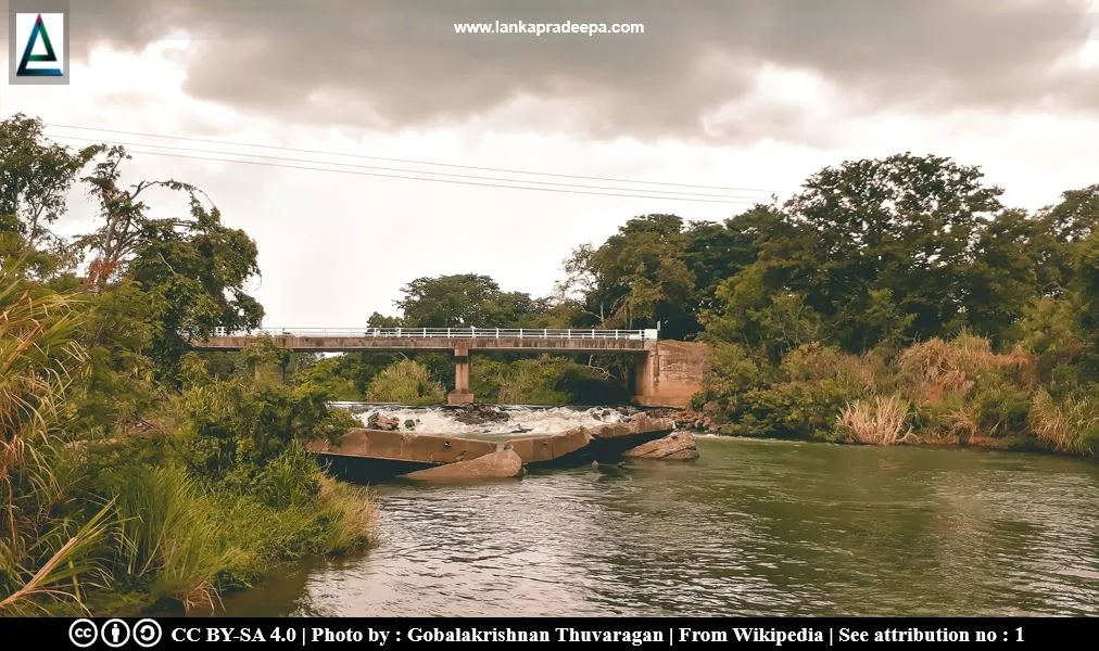
The river flows through all three climatic regions in which 94% of the area falls into the intermediate zone while 5% and 1% of the area belongs to the wet and dry zones, respectively (Jayasena et al., 2008). The Deduru Oya Reservoir was built across this river about 300 m upstream of the existing Ridi Bendi Ella anicut in 2014 under the Deduru Oya Project by the Ministry of Irrigation.
Reservoirs & Anicuts in the Deduru Oya River Basin
-
#) Batalagoda Wewa
#) Diyature Anicut
#) Hakwatunu Oya Wewa
#) Kimbulwana Wewa
#) Magalle Wewa
#) Wanara Wewa
-
#) Deduru Oya Anicut
#) Galkissa Bemma Anicut
#) Karawita Yoda Ela
#) Kospothu Oya Anicut
#) Ridi Bendi Ela Anicut
#) Yakadapotha Maha Wewa
Related Posts
Read Also
References
Books, Journal Articles
1) Arumugam, S., 1969. Water resources of Ceylon: its utilisation and development. Water Resources Board. pp.366-373.
2) Jayasena, H.A.H., Chandrajith, R. and Dissanayake, C.B., 2008. Spatial variation of isotope composition in precipitation in a tropical environment: a case study from the Deduru Oya river basin, Sri Lanka. Hydrological Processes: An International Journal, 22(23), pp.4565-4570.
3) Lakmali, W.A.S., Gunawardena, E.R.N. and Dayawansa, N.D.K., 2015. Comparative performance assessment of major irrigation systems in Upper Deduru Oya Basin. pp.343-354.
4) Mishra, B.K., Herath, S., Sampath, D.S., Fukushi, K. and Weerakoon, S.B., 2017. Modeling water allocation options in Deduru Oya reservoir system, Sri Lanka. Sustainable Water Resources Management, 3(2), pp.181-191.
5) Nicholas, C. W., 1963. Historical topography of ancient and medieval Ceylon. Journal of the Ceylon Branch of the Royal Asiatic Society, New Series (Vol VI). Special Number: Colombo. Royal Asiatic Society (Ceylon
Branch). p.97.
6) Somaratne, P.G., Jinapala, K., Perera, L.R., Ariyaratne, B.R., Bandaragoda, D.J. and Makin, I., 2003. Developing effective institutions for water resources management: A case study in the Deduru Oya Basin, Sri Lanka (Vol. 58). IWMI. p.4.
7) Wickramaarachchi, T.N., 2004. Preliminary assessment of surface water resources-a study from Deduru Oya Basin of Sri Lanka. APHW Proceedings.
Location Map
Dynamic Google Map
Attribution
To Whom
1) Deduru oya by Gobalakrishnan Thuvaragan is licensed under CC BY-SA 4.0
