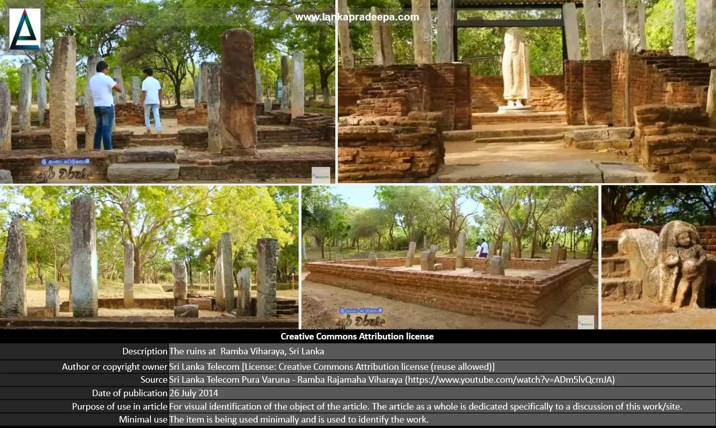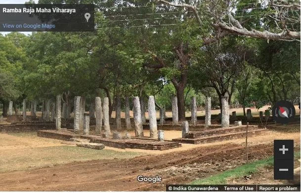
Ramba Raja Maha Viharaya (Sinhala: රම්බා විහාරය) is a Buddhist temple situated near the bank of Walawe Ganga River in Pallerota village in Hambantota District, Sri Lanka.
History
In ancient times, the area to the west of the Walawe Ganga river was known as Dvadasasahassa or Dolosdahas-rata [(the district of twelve-thousand villages) Nicholas, 1963]. Its capital was Mahanagahula which is called in Sinhalese literature "Manavulupuraya" (Nicholas, 1963). The area where the present Ramba Viharaya is located has been identified by scholars as this ancient Mahanagahula city (Nicholas, 1963).
The history of Mahanagahula is linked with the activities of King Vijayabahu I (1055-1110 A.D.) who made it his capital during his campaigns against South Indian Cholas who had the power in the northern part of the country at the time. Mahanagahula was the locality from where Vijayabahu I launched his attacks against Cholas (Nicholas, 1963). King Gajabahu II (1132-1153 A.D.) is said to have resided at Mahanagahula and also King Parakramabahu I (1153-1186 A.D.) lived there as a youth with his uncle (Nicholas, 1963). It is believed that this city converted to a religious centre during the reign of Parakramabahu I (Abeyawardana, 2004). A fragmentary pillar inscription of the 10th century and a slab inscription belonging to King Nissankamalla (1187-1196 A.D.) have been unearthed from this site (Ranawella, 2005; Ranawella, 2007).
The present name of this Viharaya is derived from the fact that there were many Ramba (banana) trees around this area (Abeyawardana, 2004). The Manavulu Sandeshaya composed in the 13th century by a priest named Mahanagasena is said to have lived in Ramba Viharaya (Abeyawardana, 2004).
Monuments
The Central Cultural Fund (CCF) has uncovered a number of ancient monuments from this site belonging to the period between the 5-10th centuries A.D. Excavations done at the site by them have revealed that from around the 12th century, this monastery complex was
subjected to foreign relations from various countries. Some of the main monuments in the Ramba Viharaya premises are listed below;
Image house I
This image house consists of four parts, viz; the entrance platform, the inner chamber, the Garbhagrha (the sanctum) and the ambulatory. It can be proved that the walls of this image house had been plastered with lime and smoothed on the surface to paint murals.
Image house II
This image house has been built on an elevated ground. The stone Buddha image inside this building shows signs of the Amaravati style.
Image house III
This image house once sheltered a brick-built reclining Buddha statue. Evidence is there to prove that this statue as well as the building had been plastered with lime.
Bodhigharaya
This building is square in design and at the centre of it was the Bo tree. Around the Bo tree were four brick statues of Buddha facing the cardinal directions.
Door chamber
The ruins of the entrance door to building complex no.21 have been dated by scholars to the period between the 5-10th centuries A.D. The outside walls of this entrance are decorated with terracotta figures containing the figures of lions.
This is a Prasada or palace-type building constructed between the 5-10th centuries A.D. It is believed that this is the place where Buddhist monks performed their religious rituals.
Bikkhu residential room
Although this building is not definitely identified, it is a room belonging to the type of Kuti. Believed to be a residential room used by Buddhist monks.
A protected site
The ancient and ruined structures situated in Ramba Vihara premises in Pallerota village in Ambalantota Divisional Secretariat Division are archaeological protected monuments, declared by a government gazette notification published on 19 November 1954.

Ramba Viharaya ruins (Photo credit: Indika Gunawardena, Google street view)
References
1) Abeyawardana, H.A.P., 2004. Heritage of Ruhuna: Major natural, cultural and historic sites. Colombo: The Central Bank of Sri Lanka. ISBN: 955-575-073-4. pp.116-117.
2) Nicholas, C. W., 1963. Historical topography of ancient and medieval Ceylon. Journal of the Ceylon Branch of the Royal Asiatic Society, New Series (Vol VI). Special Number: Colombo. Royal Asiatic Society (Ceylon Branch). p.69.
3) Ranawella, S., 2005. Inscription of Ceylon. Volume V, Part
III. Department of Archaeology. ISBN: 955-91-59-57-7. p.141.
4) Ranawella, S., 2007. Inscription of Ceylon. Volume VI. Department of Archaeology. ISBN: 978-955-91-59-61-2. pp.141-142.
4) Somadeva, R., 2006. Urban origins in southern Sri Lanka. Doctoral thesis in Archaeology at Uppsala University. pp.131,427.
5) The gazette notification. No: 10736. 19 November 1954.
Location Map
This page was last updated on 11 June 2023

