
|
The ruins of breached Kudavilachchiya Wewa |
Kudavilachchiya Wewa (Sinhala: කුඩාවිලච්චිය වැව නටඹුන්) is an ancient abandoned tank located within the boundary of Wilpaththu National Park in Anuradhapura District, Sri Lanka. The Mahavilachchiya Wewa Reservoir is situated about 4 km northeast of this tank.
History
Locals link the history of the Kudavilachchiya tank to Prince Saliya the son of King Dutugemunu (161-137 B.C.). Ancient Chronicles mention that King Vasabha (67-111 A.D.) built the Mayetti-vapi (also called Cayanti or Mayanti) in Pacchimadesa and it is believed that it could be either present Kudavilachchiya or nearby Mahavilachchiya Tank (Nicholas, 1963). Chronicles further reveal that the Mayetti tank was later improved by King Udaya II [(887-898 A.D.) Arumugam, 1969; Nicholas, 1963]. Although Codrington had earlier suggested that the Mayetti tank could be the present-day Nacchaduwa or Eruwewa, neither of those reservoirs is located in the Pacchimadesa (Nicholas, 1963).
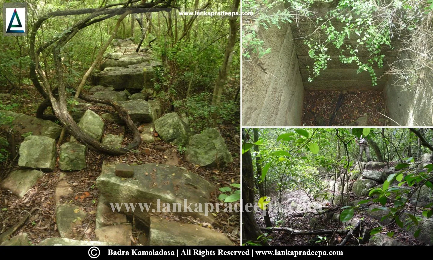
The Breached Reservoir
At present, the ruins of two Biso Kotuwas, a spill and a large earthen bund, approximately 2.55 km long, are found at the site. The earthen bund, with a maximum height of around 12.6 meters, is breached at several locations. The main breach is at Weli Ela, the primary feeder stream of the tank. It appears that the reservoir was breached due to a hydrological failure rather than a structural defect in the sluice. The Biso Kotuwas are built out of rock slabs which have been damaged recently by treasure hunters. The spillway is constructed from well-cut rock boulders, and the ancient riprap protection is visible along the upstream face of the dam. A 16th-century short inscription at the spill records "Kusaya Buduwewa" which means "May Kusaya attain Buddhahood".
Related Posts
Read Also
References
Books
1) Nicholas, C. W., 1963. Historical topography of ancient and medieval Ceylon. Journal of the Ceylon Branch of the Royal Asiatic Society, New Series (Vol VI). Special Number: Colombo. Royal Asiatic Society (Ceylon Branch). p.153.
Location Map
Dynamic Google Map
Attribution
To Whom
LankaPradeepa.com extends its gratitude to Mrs Badra Kamaladasa (Former Director General of Irrigation) for providing the necessary photographs required for this article. All the photos are published here with the permission of the author.
