
|
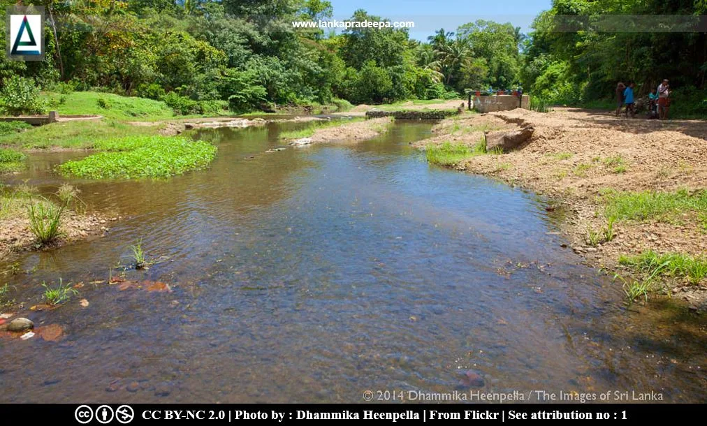
Kirindi Oya |
Kirindi Oya (Sinhala: කිරිඳි ඔය) is a river in southeast Sri Lanka. It is 118 km long and considered the 11th longest river in the country (Abeysingha et al., 2017; Vithanage, 1988).
History
The ancient name used in Pali chronicles such as Mahavamsa to identify the Kirindi Oya river was Karinda-nadi (Nicholas, 1963). The Mayilagastota Pillar Inscription of King Kassapa V (914-923 A.D.) referred to this river as Kirind-ho (Ranawella, 2001).
River Basin
The Kirindi Oya river basin extends into an area of about 1,203 km2 (Abeysingha et al., 2017). It commences from Ella near Bandarawela and extends through Wellawaya and Thanamalwila to finish up at the southern seaboard at Kirinda near Tissamaharama (Arumugam, 1969). The basin is considered closing because, during parts of the year, there are only very limited outflows to the Indian Ocean (Abeysingha et al., 2017; Molden et al., 2001). Downstream reservoirs of the basin utilize the waters of Kirindi Oya for irrigation and other uses (Abeysingha et al., 2017; Molden et al., 2001).
Reservoirs & Anicuts in the River Basin
-
#) Balaharuwa Wewa
#) Debara Wewa
#) Handapanagala Wewa
#) Pannagamuwa Wewa
#) Tissa Wewa
#) Yodha Wewa
-
#) Dambe Wewa
#) Ellagala Anicut
#) Lunugamvehera Jalashaya
#) Sudupanawela Anicut
#) Weerawila Wewa
.
Kirindi Oya Irrigation and Settlement Project
This project was carried out to develop underutilized land in the Kirindi Oya river basin. The project included the construction of the country’s largest earthfill dam with a gated spillway. After finishing the feasibility study in June 1977, the Asian Development Bank (ADB) provided necessary fundings to the government required for the work. The Project, as reformulated in 1991, was completed in early 1995.
Related Posts
Read Also
References
Books, Journal Articles
1) Abeysingha, N.S., Jayasekara, J.M.N.S. and Meegastenna, T.J., 2017. Stream flow trends in up and midstream of
Kirindi Oya river basin in Sri Lanka and its linkages to rainfall. Mausam, 68(1), pp.99-110.
2) Arumugam, S., 1969. Water resources of Ceylon: its utilisation and development. Water Resources Board. pp.122-134.
3) Molden, D.J., Starkloff, R., Sakthivadivel, R. and Keller, J., 2001. Hydronomic zones for developing basin water conservation strategies (Vol. 56). IWMI. p.12.
4) Nicholas, C. W., 1963. Historical topography of ancient and medieval Ceylon. Journal of the Ceylon Branch of the Royal Asiatic Society, New Series (Vol VI). Special Number: Colombo. Royal Asiatic Society (Ceylon Branch). p.66.
5) Ranawella, S., 2001. Inscription of Ceylon. Volume V, Part I. Department of Archaeology. ISBN: 955-9159-21-6. pp.372-376.
6) Vithanage, P.W., 1988. Relief and Drainage. The National Atlas of Sri Lanka. Survey Department of Sri Lanka. ISBN: 9559059009. pp.22-23.
Location Map
Dynamic Google Map
Attribution
To Whom
1) 20141026-_MG_0616 by Dhammika Heenpella is licensed under CC BY-NC 2.0
